Faceville Landing Park
Campground · Florida · 1 bookable site ·
Managed by the US Army Corps of Engineers
Seminole Recreation Area (Recreation Area) · Open Access
- 1
- Bookable site
- up to 48
- People per site
- 98 ft
- Elevation

Overview
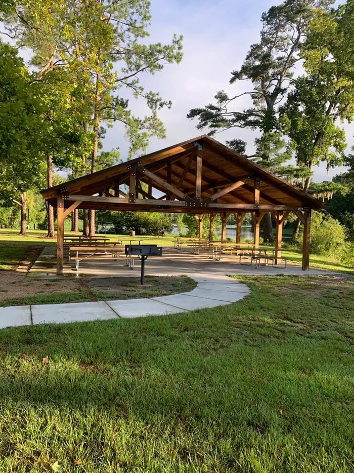
Faceville Landing picnic shelter is located on Lake Seminole in Southwest Georgia. The lake and surrounding area provide a variety of outdoor recreational opportunities for fishing, camping, boating, picnicking, hiking, biking and birding. Faceville offers ample opportunites for bank fishing or picnicing in a quiet cove.
Recreation
Lake Seminole is known as one of the best sites for sports fishing in America. Extensive stump and grass beds provide abundant cover where anglers fish for largemouth, hybrid, striped and white bass. Sizable populations of catfish, crappie and bream are also present. Over 79 species of fish have been identified in the lake.
Facilities
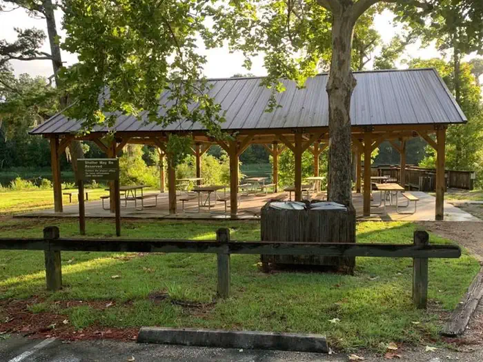
Faceville Landing Park has pit toilet restroom facilities within walking distance to the shelter. A boat ramp provides access to the lake. The park has a fishing pier. There are 8 picnic tables and a grill located at the shelter. No water or electricity is available at this shelter.
Natural Features
Lake Seminole has a surface area of 37,500 acres with 376 miles of shoreline. A pine and hardwood forest covers the rolling hills around the lake.
A variety of wildlife makes its home around Seminole Lake, including raccoons, alligators, ring-necked ducks, canvasbacks, scaup, hawks, bald eagles, black vultures, tortoises and snakes.
Contact Info
For facility specific information, please call (229) 662-2001.The facts
- 1 bookable site
- 1 site for day use only
- Up to 48 people per site
Site types
- 1 Group Shelter Nonelectric
Amenities
- Grills
Not recorded upstream: electric hookups, water hookups, sewer hookups, campfires allowed, fire pits, picnic tables, shade, pets allowed.
1 campsite at Faceville Landing Park
| Site | Loop | Type | Entry | Surface | Max rig | People | |
|---|---|---|---|---|---|---|---|
| Faceville Shelter (Building #L36A) | — | Group Shelter Nonelectric | — | — | — | 48 |
Getting there
From Bainbridge: Take GA Hwy 97 (Faceville Hwy) south for approximately 13 miles. Turn right onto Faceville Landing Road. The road dead ends in the park.
From Hwy 90: Take GA Hwy 97 (Faceville Hwy) north for approximately 8 miles. Turn left onto Faceville Landing Road. The road dead ends in the park.
30.78576, -84.66545 · 30°47'8.7"N 84°39'55.6"W
Typical weather
Typically 93°F in Jul, down to 64°F in Jan.
| Jan | Feb | Mar | Apr | May | Jun | Jul | Aug | Sep | Oct | Nov | Dec | |
|---|---|---|---|---|---|---|---|---|---|---|---|---|
| High °F | 64 | 67 | 74 | 80 | 88 | 92 | 93 | 92 | 90 | 82 | 73 | 66 |
| Low °F | 38 | 41 | 47 | 52 | 61 | 69 | 71 | 70 | 66 | 56 | 46 | 40 |
| Precip in | — | — | — | — | — | — | — | — | — | — | — | — |
1991–2020 averages from the nearest NOAA station, 3.8 mi away — not measured at the facility itself, and elevation can make a real difference over that distance.
Map
More photos
Member photos
Common questions about Faceville Landing Park
- Can you reserve a site at Faceville Landing Park?
- Yes, Faceville Landing Park is reservable through Recreation.gov.
- How many campsites does Faceville Landing Park have?
- 1 site.
Camping near Faceville Landing Park
- Hales Landing Park 4.3 mi · Campground · we watch it
- Rays Lake Park 11.6 mi · Campground · we watch it
- Chattahoochee Park 11.7 mi · Campground · we watch it
- Eastbank 12 mi · Campground · we watch it
- Camel Lake Campground 40 mi · Campground · we watch it
- Buckhorn Hunt Camp 32.2 mi · Campground
- Brown House Hunt Camp 34.7 mi · Campground
- Otter Hunt Camp 40.5 mi · Campground
- Pope Still Hunt Camp 40.5 mi · Campground
- Porter Lake 42.1 mi · Campground
- Twin Poles Hunt Camp 47 mi · Campground
- Cliff Lake Hunt Camp 47.4 mi · Campground
Contact
- Phone 229-662-2001
- Book Recreation.gov
Recreation.gov last updated this record on 2026-02-25.
Facility information and photographs from Recreation.gov (RIDB). SpotOpened is not affiliated with Recreation.gov or any federal agency.
Comments