Tortilla Campground
Campground · Arizona · 76 bookable sites ·
Managed by the USDA Forest Service
Tonto National Forest (NF) · Open Access
- 76
- Bookable sites
- 32 ft
- Max rig length
- up to 10
- People per site
- 1,756 ft
- Elevation
Overview
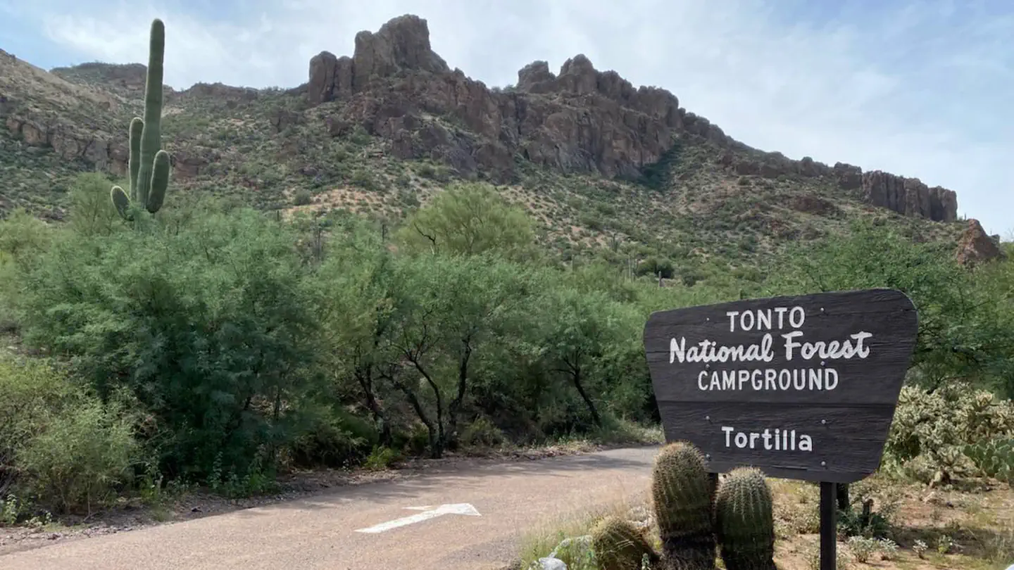
Tortilla Campground is a winter campground just outside of the Phoenix metropolitan area. From October through April each year, urban dwellers take advantage of cooler temperatures and enjoy boating, fishing, hiking, rock climbing and scenic driving throughout the surrounding Tonto National Forest. Campers awake to a scenic backdrop of rugged bluffs, saguaro cactus and desert skies. The campground is located directly across from Tortilla Flat Restaruant and general store, which is just a short walk away.
Recreation
The area is rich with human history, scenery and outdoor recreation. The campground lies along the Canyon Lake Apache Trail Scenic Byway, a former Apache Tribal route turned stagecoach road. Visitors may hear stories of lost cowboys and gold mining. The drive to the campground provides ample scenery and a vista point perfect for photography and wildlife viewing. The campground is just down the road from Canyon Lake which provides a number of recreational opportunites such as kayaking, fishing, and boating. The Superstition Wilderness has a well-developed trail system, and the western end of the wilderness receives heavy use during the cooler times of the year. Use caution as trail conditions can be fair or poor, and several are unsuitable for horses. Also make sure to check out many of the developed recreation sites along Canyon lake for shoreline and fishing dock access, but keep in mind these sites require a day pass not included in the camping fees.
Facilities
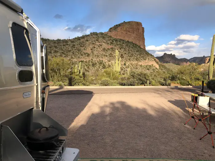
The campground is large yet compact, with campsites in close proximity of one another. Every campsite has a view of the surrounding desert, some with views of mountain peaks and cliffs. The facility accommodates RVs and has sewage hookups. Each campsite comes with a picnic table and a campfire ring with a cooking grate. Services at the end of Tortilla Flat include a post office, restaurant, gift shop and public cellular credit card phone (emergency 911). Canyon Lake and Marina is located two miles west and includes public boat launches and picnic/fishing sites, a restaurant, excursion boats and boat rentals.
Natural Features
The Superstition Wilderness Area is starkly beautiful and untamed. A series of dams has created numerous lakes along the Salt River. Blossoming plants bring the desert to life each spring with vibrant wildflowers. This area is a photographers dream with plenty of opportunities to capture Bighorn Sheep, Deer, and other desert widlife. The area can be harsh for travelers not equipped to meet nature on her own terms. Soaring temperatures and little water are typical conditions in the summer. In winter, temperatures are typically pleasant during the day but drop significantly at night. Visitors should come prepared for anything, even the occasional rain or snow.
Nearby Attractions
Fish Creek Vista Point is approx. 7 miles east on AZ-88, this area provides great views of the desert and an accessible interpretive trail great for learning about the history of the area.
The facts
- Season: October 1 – March 31 — USDA Forest Service, Aug 24, 2026
- 76 bookable sites
- Vehicles up to 32 ft
- Up to 10 people per site
- Loops: Main
Site types
- 76 Standard Nonelectric
Amenities
- Water hookups
- Sewer hookups
- Campfires allowed
- Fire pits
- Picnic tables
- Grills
- Pets allowed
Not recorded upstream: electric hookups, shade.
76 campsites at Tortilla Campground
Check-in 12:00 PM · Check-out 10:00 AM
| Site | Loop | Type | Entry | Surface | Grade | Max rig | People | |
|---|---|---|---|---|---|---|---|---|
| 1 | Main | Standard Nonelectric | Back In | Gravel | Slight | 32 ft | 10 | 🐾 |
| 10 | Main | Standard Nonelectric | Back In | Gravel | Slight | 32 ft | 10 | 🐾 |
| 11 | Main | Standard Nonelectric | Back In | Gravel | Slight | 32 ft | 10 | 🐾 |
| 12 | Main | Standard Nonelectric | Back In | Gravel | Slight | 32 ft | 10 | 🐾 |
| 13 | Main | Standard Nonelectric | Back In | Gravel | Slight | 32 ft | 10 | 🐾 |
| 14 | Main | Standard Nonelectric | Back In | Gravel | Slight | 32 ft | 10 | 🐾 |
| 15 | Main | Standard Nonelectric | Back In | Gravel | Slight | 32 ft | 10 | 🐾 |
| 16 | Main | Standard Nonelectric | Back In | Gravel | Slight | 32 ft | 10 | 🐾 |
| 17 | Main | Standard Nonelectric | Back In | Gravel | Slight | 32 ft | 10 | 🐾 |
| 18 | Main | Standard Nonelectric | Back In | Gravel | Slight | 32 ft | 10 | 🐾 |
| 19 | Main | Standard Nonelectric | Back In | Gravel | Slight | 32 ft | 10 | 🐾 |
| 2 | Main | Standard Nonelectric | Back In | Gravel | Slight | 32 ft | 10 | 🐾 |
| 20 | Main | Standard Nonelectric | Back In | Gravel | Slight | 32 ft | 10 | 🐾 |
| 21 | Main | Standard Nonelectric | Back In | Gravel | Slight | 32 ft | 10 | 🐾 |
| 22 | Main | Standard Nonelectric | Back In | Gravel | Slight | 32 ft | 10 | 🐾 |
| 23 | Main | Standard Nonelectric | Back In | Gravel | Slight | 32 ft | 10 | 🐾 |
| 24 | Main | Standard Nonelectric | Back In | Gravel | Slight | 32 ft | 10 | 🐾 |
| 25 | Main | Standard Nonelectric | Back In | Gravel | Slight | 32 ft | 10 | 🐾 |
| 26 | Main | Standard Nonelectric | Back In | Gravel | Slight | 32 ft | 10 | 🐾 |
| 27 | Main | Standard Nonelectric | Back In | Gravel | Slight | 32 ft | 10 | 🐾 |
| 28 | Main | Standard Nonelectric | Back In | Gravel | Slight | 32 ft | 10 | 🐾 |
| 29 | Main | Standard Nonelectric | Back In | Gravel | Slight | 32 ft | 10 | 🐾 |
| 3 | Main | Standard Nonelectric | Back In | Gravel | Slight | 32 ft | 10 | 🐾 |
| 30 | Main | Standard Nonelectric | Back In | Gravel | Slight | 32 ft | 10 | 🐾 |
| 31 | Main | Standard Nonelectric | Back In | Gravel | Slight | 32 ft | 10 | 🐾 |
| 32 | Main | Standard Nonelectric | Back In | Gravel | Slight | 32 ft | 10 | 🐾 |
| 33 | Main | Standard Nonelectric | Back In | Gravel | Slight | 32 ft | 10 | 🐾 |
| 34 | Main | Standard Nonelectric | Back In | Gravel | Slight | 32 ft | 10 | 🐾 |
| 35 | Main | Standard Nonelectric | Back In | Gravel | Slight | 32 ft | 10 | 🐾 |
| 36 | Main | Standard Nonelectric | Back In | Gravel | Slight | 32 ft | 10 | 🐾 |
| 37 | Main | Standard Nonelectric | Back In | Gravel | Slight | 32 ft | 10 | 🐾 |
| 38 | Main | Standard Nonelectric | Back In | Gravel | Slight | 32 ft | 10 | 🐾 |
| 39 | Main | Standard Nonelectric | Back In | Gravel | Slight | 32 ft | 10 | 🐾 |
| 4 | Main | Standard Nonelectric | Back In | Gravel | Slight | 32 ft | 10 | 🐾 |
| 40 | Main | Standard Nonelectric | Back In | Gravel | Slight | 32 ft | 10 | 🐾 |
| 41 | Main | Standard Nonelectric | Back In | Gravel | Slight | 32 ft | 10 | 🐾 |
| 42 | Main | Standard Nonelectric | Back In | Gravel | Slight | 32 ft | 10 | 🐾 |
| 43 | Main | Standard Nonelectric | Back In | Gravel | Slight | 32 ft | 10 | 🐾 |
| 44 | Main | Standard Nonelectric | Back In | Gravel | Slight | 32 ft | 10 | 🐾 |
| 45 | Main | Standard Nonelectric | Back In | Gravel | Slight | 32 ft | 10 | 🐾 |
| 46 | Main | Standard Nonelectric | Back In | Gravel | Slight | 32 ft | 10 | 🐾 |
| 47 | Main | Standard Nonelectric | Back In | Gravel | Slight | 32 ft | 10 | 🐾 |
| 48 | Main | Standard Nonelectric | Back In | Gravel | Slight | 32 ft | 10 | 🐾 |
| 49 | Main | Standard Nonelectric | Back In | Gravel | Slight | 32 ft | 10 | 🐾 |
| 5 | Main | Standard Nonelectric | Back In | Gravel | Slight | 32 ft | 10 | 🐾 |
| 50 | Main | Standard Nonelectric | Back In | Gravel | Slight | 32 ft | 10 | 🐾 |
| 51 | Main | Standard Nonelectric | Back In | Gravel | Slight | 32 ft | 10 | 🐾 |
| 52 | Main | Standard Nonelectric | Back In | Gravel | Slight | 32 ft | 10 | 🐾 |
| 53 | Main | Standard Nonelectric | Back In | Gravel | Slight | 32 ft | 10 | 🐾 |
| 54 | Main | Standard Nonelectric | Back In | Gravel | Slight | 32 ft | 10 | 🐾 |
| 55 | Main | Standard Nonelectric | Back In | Gravel | Slight | 32 ft | 10 | 🐾 |
| 56 | Main | Standard Nonelectric | Back In | Gravel | Slight | 32 ft | 10 | 🐾 |
| 57 | Main | Standard Nonelectric | Back In | Gravel | Slight | 32 ft | 10 | 🐾 |
| 58 | Main | Standard Nonelectric | Back In | Gravel | Slight | 32 ft | 10 | 🐾 |
| 59 | Main | Standard Nonelectric | Back In | Gravel | Slight | 32 ft | 10 | 🐾 |
| 6 | Main | Standard Nonelectric | Back In | Gravel | Slight | 32 ft | 10 | 🐾 |
| 60 | Main | Standard Nonelectric | Back In | Gravel | Slight | 32 ft | 10 | 🐾 |
| 61 | Main | Standard Nonelectric | Back In | Gravel | Slight | 32 ft | 10 | 🐾 |
| 62 | Main | Standard Nonelectric | Back In | Gravel | Slight | 32 ft | 10 | 🐾 |
| 63 | Main | Standard Nonelectric | Back In | Gravel | Slight | 32 ft | 10 | 🐾 |
| 64 | Main | Standard Nonelectric | Back In | Gravel | Slight | 32 ft | 10 | 🐾 |
| 65 | Main | Standard Nonelectric | Back In | Gravel | Slight | 32 ft | 10 | 🐾 |
| 66 | Main | Standard Nonelectric | Back In | Gravel | Slight | 32 ft | 10 | 🐾 |
| 67 | Main | Standard Nonelectric | Back In | Gravel | Slight | 32 ft | 10 | 🐾 |
| 68 | Main | Standard Nonelectric | Back In | Gravel | Slight | 32 ft | 10 | 🐾 |
| 69 | Main | Standard Nonelectric | Back In | Gravel | Slight | 32 ft | 10 | 🐾 |
| 7 | Main | Standard Nonelectric | Back In | Gravel | Slight | 32 ft | 10 | 🐾 |
| 70 | Main | Standard Nonelectric | Back In | Gravel | Slight | 32 ft | 10 | 🐾 |
| 71 | Main | Standard Nonelectric | Back In | Gravel | Slight | 32 ft | 10 | 🐾 |
| 72 | Main | Standard Nonelectric | Back In | Gravel | Slight | 32 ft | 10 | 🐾 |
| 73 | Main | Standard Nonelectric | Back In | Gravel | Slight | 32 ft | 10 | 🐾 |
| 74 | Main | Standard Nonelectric | Back In | Gravel | Slight | 32 ft | 10 | 🐾 |
| 75 | Main | Standard Nonelectric | Back In | Gravel | Slight | 32 ft | 10 | 🐾 |
| 76 | Main | Standard Nonelectric | Back In | Gravel | Slight | 32 ft | 10 | 🐾 |
| 8 | Main | Standard Nonelectric | Back In | Gravel | Slight | 32 ft | 10 | 🐾 |
| 9 | Main | Standard Nonelectric | Back In | Gravel | Slight | 32 ft | 10 | 🐾 |
Getting there
From Mesa, Arizona, take U.S. Highway 60 to the Idaho Road exit. Go north to State Route 88 (Apache Trail) and turn right. Continue for 18 miles on Route 88 to Tortilla Flat (the campground is two miles past Canyon Lake). Tortilla Campground is directly across from Tortilla Flat, on the left side of the road. The entire route is paved, narrow and has sharp curves; traffic can be heavy.
33.52987, -111.39844 · 33°31'47.5"N 111°23'54.4"W
Typical weather
Typically 106°F in Jul, down to 65°F in Dec.
| Jan | Feb | Mar | Apr | May | Jun | Jul | Aug | Sep | Oct | Nov | Dec | |
|---|---|---|---|---|---|---|---|---|---|---|---|---|
| High °F | 68 | 70 | 77 | 85 | 94 | 104 | 106 | 104 | 98 | 89 | 75 | 65 |
| Low °F | 44 | 45 | 50 | 55 | 64 | 73 | 80 | 79 | 74 | 63 | 52 | 44 |
| Precip in | 1.9 | 1.5 | 1.7 | 0.5 | 0.3 | 0.0 | 1.3 | 1.4 | 0.5 | 0.7 | 0.4 | 1.7 |
1991–2020 averages from the nearest NOAA station, 3.1 mi away — not measured at the facility itself, and elevation can make a real difference over that distance.
Map
More photos

Member photos
Common questions about Tortilla Campground
- Can you reserve a site at Tortilla Campground?
- Yes, Tortilla Campground is reservable through Recreation.gov.
- How many campsites does Tortilla Campground have?
- 76 sites.
- What is the maximum RV length at Tortilla Campground?
- 32 ft. That is the longest vehicle the sites here are recorded as taking; individual sites may be shorter.
- Are pets allowed at Tortilla Campground?
- Yes, pets are allowed at Tortilla Campground.
- Does Tortilla Campground have hookups?
- Water, Sewer.
- Are campfires allowed at Tortilla Campground?
- Campfires are allowed at Tortilla Campground. Check for a current fire restriction before you go.
Also listed by
Tortilla Campground also appears in other federal recreation data. Facts below are matched by name and location, not confirmed by Tortilla Campground's operator.
USDA Forest Service — data as of Aug 24, 2026
- $20/site/night. America the Beautiful Interagency Senior or Access Pass holders receive a 50% discount on a single campsite. Passholders must be present. An automated fee machine at the entrance of the campground must be used to purchase permits for first-come, first-served sites. Cash and checks ar
Restrictions:
- 14-day stay limit.
- Maximum trailer length is 30 feet.
- Campsites must be occupied the first night.
- Camping equipment/personal property may not be left for more than 24 hours (without permission).
- All vehicles operating within the campground must be registered and street legal.
- Recreational OHV riding is not permitted within the campground.
- Pets are allowed, but must be crated or kept on a leash no longer than 6 feet.
- Campfires are permitted in approved fire rings only.
- Fires must always be attended.
- Dead and down vegetation may be collected for your campfire; however, cutting or removing live vegetation is prohibited.
- Please use provided trash receptacles or pack it in, pack it out.
- Quiet hours are from 10:00 pm to 6:00 am (running generators is not permitted during quiet hours).
Camping near Tortilla Campground
- Burnt Corral Campground 13.1 mi · Campground · we watch it
- Cholla Campground 17.9 mi · Campground · we watch it
- Frazier Horse Campground 18.1 mi · Campground · we watch it
- Frazier Group Campground 18.2 mi · Campground · we watch it
- Windy Hill Campground 20.2 mi · Campground · we watch it
- Palo Verde 1.8 mi · Facility
- The Point Boat Dock, Campground and Picnic Area 2 mi · Campground
- Bagley Flat Campground and Boat Dock 5.7 mi · Campground
- Phon D Sutton 15 mi · Facility
- Granite Reef 16.4 mi · Facility
- Visitor Center 18.3 mi · Facility
- Indian Point 18.7 mi · Campground
Contact
- Phone (480)610-3300
- Book Recreation.gov
Recreation.gov last updated this record on 2026-03-11.
Facility information and photographs from Recreation.gov (RIDB). SpotOpened is not affiliated with Recreation.gov or any federal agency.
Comments