Spillway (Az)
Campground · Arizona · 24 bookable sites ·
Managed by the USDA Forest Service
Sitgreaves National Forest (NF) · Open Access
- 24
- Bookable sites
- 45 ft
- Max rig length
- up to 25
- People per site
- 22
- Accessible sites
- 7,520 ft
- Elevation
Overview
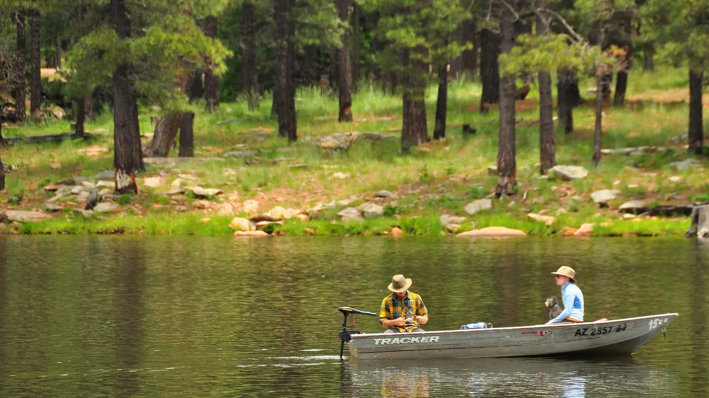
Spillway Campground is on the shores of popular Woods Canyon Lake near the town of Heber in north central Arizona. Situated in a pine forest with plenty of shade, the campground has individual campsites as well as one group campsite for small gatherings. Given its proximity to the lake, hiking trails and scenic areas, Spillway is a convenient getaway for anglers, boaters, hikers, families and photographers.Recreation
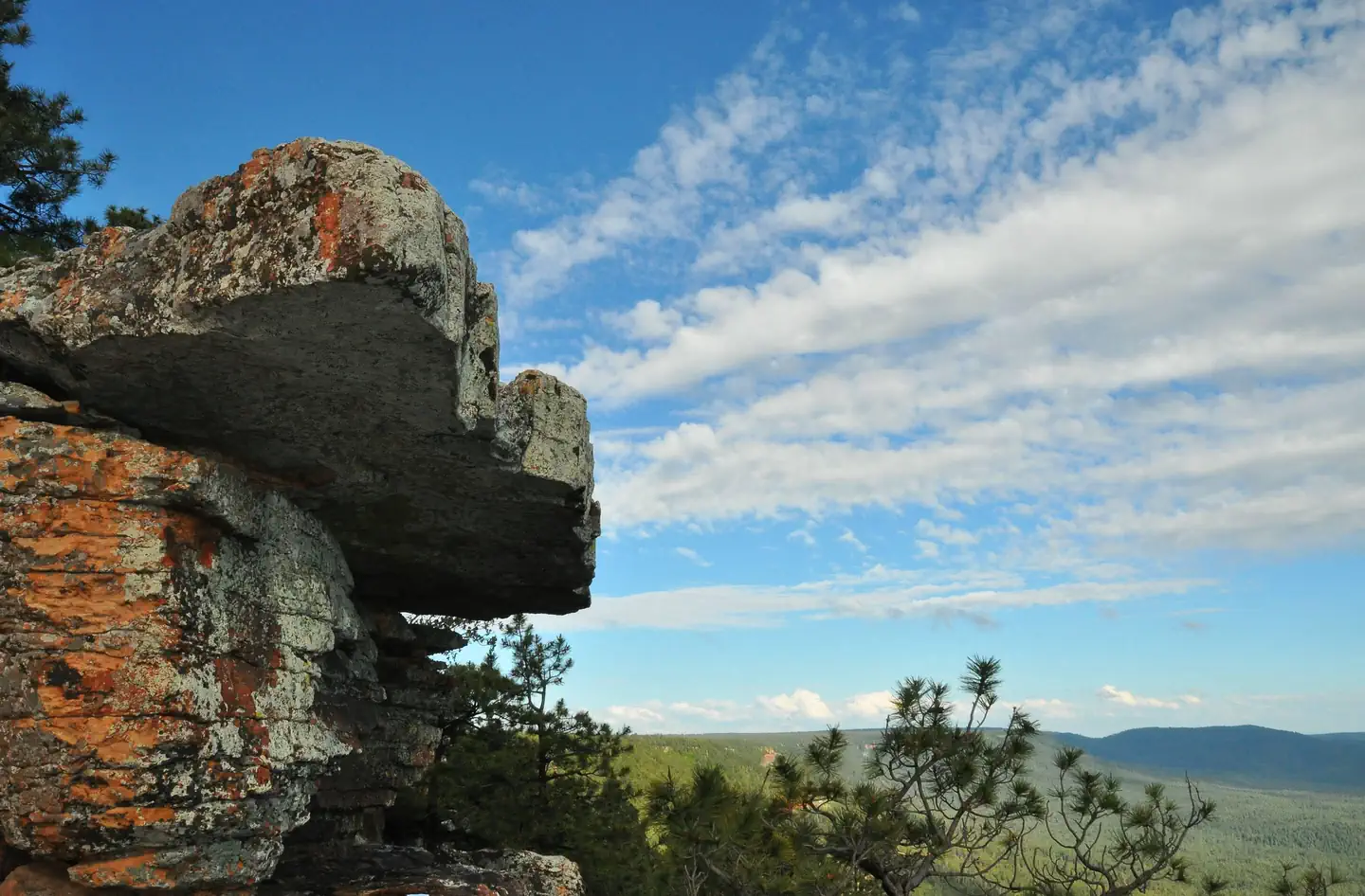
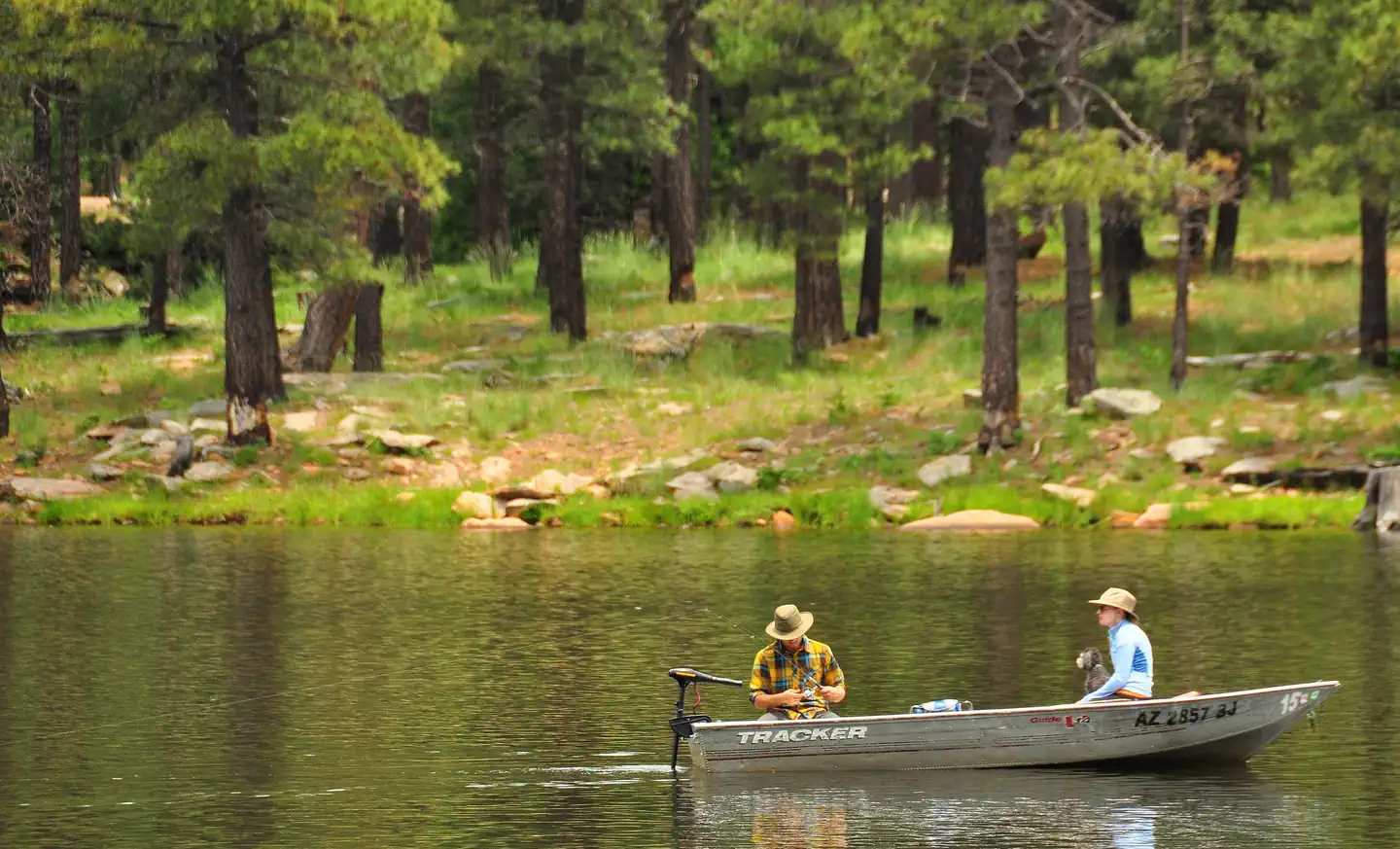
Woods Canyon Lake is one of seven lakes in the Rim Lakes Recreation Area, and one of the most visited. Trout fishing (both lake and stream) is a favorite pastime. Woods Canyon Lake only allows electric boat motors. Two other lakes are within a short drive.The Rim Lakes Vista Trail, less than a mile from the campground, and others in the area lead to spectacular views of the Mogollon Rim. An easy hiking trail meanders around the lake, and the paved roads in the recreation area make for great afternoon bike rides.
Families might also enjoy attending educational programs given by Forest Service rangers on the weekends.
Facilities
The campground is a relatively small facility with 26 individual campsites and one group site that can accommodate up to 25 people. Tents, trailers and small motorhomes are allowed - please read information on each individual spur size to determine if your RV will fit in the site. The main campground loop road has a fairly tight turning radius hedged by trees so no RV/trailer over 32' is recommended. Each shaded campsite offers a leveled spur, picnic table, fire ring, and charcoal grill. All campsites, loop road, vault restrooms, and water hydrants are compliant with the Architectural Barriers Act for accessibility. Some sites are directly on the lakeshore with a view of the water.
Restrooms are provided. Boat rentals and basic camping supplies are available at the Woods Canyon Store, while the nearest showers are at Canyon Point Campground 10 miles away.
Natural Features
Spillway is located in a thick forest of ponderosa pine, oak and Douglas fir at an elevation of 7,500 ft. The campground is situated on the lakeshore overlooking the calm blue waters of 52-acre Woods Canyon Lake, where visitors may see squirrels, deer, elk and a variety of birds.Nearby hiking trails offer views of the Mogollon Rim, a 200-mile long cliff in northern Arizona that ranges between 5,000 and 7,000 feet in elevation and serves as the geographical dividing line between the cool high country above and the hot, dry desert below.
Summer temperatures can be very pleasant because of the elevation. However, the rainy season often brings afternoon thunderstorms from late June through August. Visitors should come prepared for rain and cool nighttime temperatures.
Contact Info
For facility specific information, please call (928) 535-0181.Nearby Attractions
Gas, phone and groceries are available 10 miles east at Forest Lakes. The nearest full service community is Payson, Arizona, 35 miles west on Highway 260.Visitors can explore endless vistas and take part in many outdoor activities in the surrounding Apache-Sitgreaves National Forest, which encompasses 2 million acres of magnificent mountain country in east-central Arizona and New Mexico.
The facts
- Season: April 29 – Closes October 31 Annually — USDA Forest Service, Aug 24, 2026
- 24 bookable sites
- 28 sites in total, including non-bookable
- 22 accessible sites
- Vehicles up to 45 ft
- Up to 25 people per site
- Loops: GRP, MANAGEMENT SITES, SPIL
Site types
- 23 Standard Nonelectric
- 4 Management
- 1 Group Standard Nonelectric
Amenities
- Campfires allowed
- Fire pits
- Picnic tables
- Grills
- Shade
- Pets allowed
- Water hookups — not available
Not recorded upstream: electric hookups, sewer hookups.
28 campsites at Spillway (Az)
| Site | Loop | Type | Entry | Surface | Grade | Water | Max rig | People | |
|---|---|---|---|---|---|---|---|---|---|
| 1 | GRP | Group Standard Nonelectric | Back In | Gravel | Slight | — | 35 ft | 25 | 🐾 |
| 001 | MANAGEMENT SITES | Management | — | — | — | — | — | — | |
| 002 | MANAGEMENT SITES | Management | — | — | — | — | — | — | |
| 026 | MANAGEMENT SITES | Management | — | — | — | — | — | — | |
| XXX | MANAGEMENT SITES | Management | Back In | Paved | — | — | 13 ft | 8 | |
| 003 | SPIL | Standard Nonelectric | Back In | Gravel | Slight | — | 45 ft | 8 | ♿ 🐾 |
| 004 | SPIL | Standard Nonelectric | Back In | Gravel | Slight | — | 35 ft | 8 | ♿ 🐾 |
| 005 | SPIL | Standard Nonelectric | Pull Through | Gravel | — | — | 25 ft | 8 | 🐾 |
| 006 | SPIL | Standard Nonelectric | Back In | Gravel | — | — | 42 ft | 8 | ♿ 🐾 |
| 007 | SPIL | Standard Nonelectric | Back In | Gravel | — | — | 30 ft | 8 | ♿ 🐾 |
| 008 | SPIL | Standard Nonelectric | Back In | Gravel | Slight | — | 25 ft | 8 | ♿ 🐾 |
| 009 | SPIL | Standard Nonelectric | Pull Through | Gravel | Slight | — | 26 ft | 8 | ♿ 🐾 |
| 010 | SPIL | Standard Nonelectric | Back In | Gravel | Slight | — | 26 ft | 8 | ♿ 🐾 |
| 011 | SPIL | Standard Nonelectric | Pull Through | Gravel | Slight | — | 26 ft | 8 | ♿ 🐾 |
| 012 | SPIL | Standard Nonelectric | Back In | Gravel | — | — | 26 ft | 8 | ♿ 🐾 |
| 013 | SPIL | Standard Nonelectric | Back In | Gravel | Slight | — | 26 ft | 8 | ♿ 🐾 |
| 014 | SPIL | Standard Nonelectric | Back In | Gravel | Slight | — | 26 ft | 8 | ♿ 🐾 |
| 015 | SPIL | Standard Nonelectric | Back In | Gravel | Slight | — | 26 ft | 8 | ♿ 🐾 |
| 016 | SPIL | Standard Nonelectric | Back In | Gravel | — | — | 26 ft | 8 | ♿ 🐾 |
| 017 | SPIL | Standard Nonelectric | Back In | Gravel | — | — | 22 ft | 8 | ♿ 🐾 |
| 018 | SPIL | Standard Nonelectric | Back In | Gravel | — | — | 26 ft | 8 | ♿ 🐾 |
| 019 | SPIL | Standard Nonelectric | Back In | Gravel | — | — | 22 ft | 8 | ♿ 🐾 |
| 020 | SPIL | Standard Nonelectric | Back In | Gravel | — | — | 26 ft | 8 | ♿ 🐾 |
| 021 | SPIL | Standard Nonelectric | Back In | Gravel | — | Lakefront | 26 ft | 8 | ♿ 🐾 |
| 022 | SPIL | Standard Nonelectric | Back In | Gravel | — | — | 26 ft | 8 | ♿ 🐾 |
| 023 | SPIL | Standard Nonelectric | Back In | Gravel | — | Lakefront | 26 ft | 8 | ♿ 🐾 |
| 024 | SPIL | Standard Nonelectric | Back In | — | — | Lakefront | 19 ft | 8 | ♿ 🐾 |
| 025 | SPIL | Standard Nonelectric | Back In | Gravel | — | — | 26 ft | 8 | ♿ 🐾 |
Getting there
34.33194, -110.93639 · 34°19'55.0"N 110°56'11.0"W
Typical weather
| Jan | Feb | Mar | Apr | May | Jun | Jul | Aug | Sep | Oct | Nov | Dec | |
|---|---|---|---|---|---|---|---|---|---|---|---|---|
| High °F | — | — | — | — | — | — | — | — | — | — | — | — |
| Low °F | — | — | — | — | — | — | — | — | — | — | — | — |
| Precip in | 4.9 | 5.1 | 3.6 | 1.4 | 0.9 | 0.3 | 3.1 | 3.8 | 2.2 | 1.8 | 2.7 | 4.6 |
1991–2020 averages from the nearest NOAA station, 5 mi away — not measured at the facility itself, and elevation can make a real difference over that distance.
Map
More photos
Member photos
Common questions about Spillway (Az)
- Can you reserve a site at Spillway (Az)?
- Yes, Spillway (Az) is reservable through Recreation.gov.
- How many campsites does Spillway (Az) have?
- 28 sites in total, of which 24 can be booked.
- What is the maximum RV length at Spillway (Az)?
- 45 ft. That is the longest vehicle the sites here are recorded as taking; individual sites may be shorter.
- Are pets allowed at Spillway (Az)?
- Yes, pets are allowed at Spillway (Az).
- Does Spillway (Az) have hookups?
- No hookups are recorded here.
- Are campfires allowed at Spillway (Az)?
- Campfires are allowed at Spillway (Az). Check for a current fire restriction before you go.
Also listed by
Spillway (Az) also appears in other federal recreation data. Facts below are matched by name and location, not confirmed by Spillway (Az)'s operator.
USDA Forest Service — data as of Aug 24, 2026
- Single site non-electric $34 per night includes eight people and one vehicle. Extra vehicle in same site is $12 per night. Spillway day use area is $10. Spillway wedding rate is $125 a day.
Accessibility:
- Redesigned in 2018, this campground was brought up to Architectural Barriers Act standards for accessibility. All sites and vault facilities within the campground meet minimum federal accessibility standards.
Camping near Spillway (Az)
- Woods Canyon Lake Group 0.3 mi · Campground · we watch it
- Aspen (Az) 0.7 mi · Campground · we watch it
- Crook Campground 1.1 mi · Campground · we watch it
- Mogollon Campground 1.4 mi · Campground · we watch it
- Rim Campground 2.4 mi · Campground · we watch it
- Sinkhole Campground 3.5 mi · Campground · we watch it
- Sharp Creek 4.2 mi · Campground · we watch it
- Woods Canyon Lake Recreation Area 0.4 mi · Facility
- Woods Canyon Lake Area Boating Site 0.6 mi · Facility
- Carr Lake Trailhead 2 mi · Facility
- Fr 9350 Campground 2.7 mi · Campground
- Willow Springs Lake Fishing and Boating Site 3.7 mi · Facility
Contact
- Phone 928-535-9859
- Book Recreation.gov
Recreation.gov last updated this record on 2026-03-11.
Facility information and photographs from Recreation.gov (RIDB). SpotOpened is not affiliated with Recreation.gov or any federal agency.
Comments