Steel Creek Campground
Campground · Arkansas · 39 bookable sites ·
Managed by the National Park Service
Buffalo National River (National River) · Open Access
- 39
- Bookable sites
- up to 6
- People per site
- 1,562 ft
- Elevation
Overview
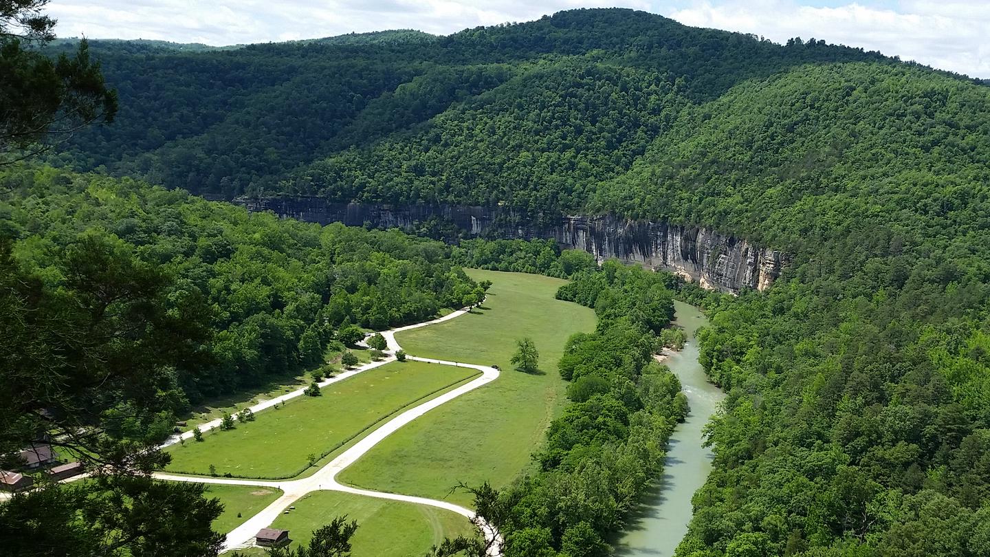
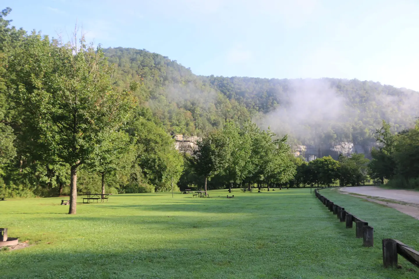
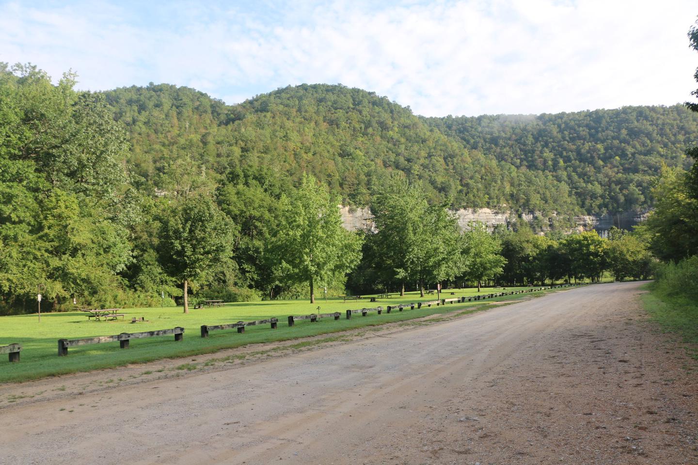
Steel Creek Campground is situated along the Buffalo River under the towering and picturesque Roark Bluff. One section of the campground offers 26 walk-in tent sites and another section of the campground offers 13 sites for those camping with horses. All sites are available by reservation only. Steel Creek is located about 3 miles (5 km) east of Ponca, just off Highway 74.
Recreation
Paddling conditions in the upper (westernmost) district of Buffalo National River are extremely dependent upon rainfall. On an average year, the upper river is only navigable by boat in the spring and early summer when consistent rainfall feeds into the watershed. Some sections on the upper end of the river are technical and should not be attempted by novices. For current paddling conditions, please check with an outfitter (visit our Guided Services web page ), call the Tyler Bend Visitor Center at 870-439-2502, or check the Buffalo National River Float Guide Dashboard
Facilities
Steel Creek has 26 tent only sites and 13 sites for campers with horses/stock animals (six people and four stock animals allowed per site). All sites are available by reservations only. There are no electrical amenities or water hookups, but flush restrooms and water spigots are available from approximately March 15 through November 15 each year.
Natural Features
The Buffalo National River flows free over swift running rapids and quiet pools for its 135-mile (217 km) length. One of the few remaining rivers in the lower 48 states without dams, the Buffalo cuts its way through massive limestone bluffs traveling eastward through the Arkansas Ozarks and into the White River.
Contact Info
For facility specific information, please call (870) 439-2502.Nearby Attractions
The Buffalo River Trail runs through Steel Creek and offers great day hiking or overnight backcountry opportunities.
Boxley Valley is nearby and is home to Lost Valley, an easy to moderate trail that leads hikers past geologic and water formations. Visit the park's Hiking Trails web page for more information..
Charges & Cancellations
The facts
- 39 bookable sites
- 40 sites in total, including non-bookable
- Up to 6 people per site
- Loops: Horse Camp, Main Loop
Site types
- 26 Tent Only Nonelectric
- 13 Equestrian Nonelectric
- 1 Management
Amenities
- Campfires allowed
- Fire pits
- Picnic tables
- Shade
- Pets allowed
Not recorded upstream: electric hookups, water hookups, sewer hookups, grills.
40 campsites at Steel Creek Campground
Check-in 1:00 PM · Check-out 12:00 PM
| Site | Loop | Type | Entry | Surface | Access | Water | Max rig | People | |
|---|---|---|---|---|---|---|---|---|---|
| 27 - Horse Site | Horse Camp | Equestrian Nonelectric | — | Gravel | Drive In | — | — | 6 | 🐾 |
| 28 - Horse Site | Horse Camp | Equestrian Nonelectric | — | Gravel | Drive In | — | — | 6 | 🐾 |
| 29 - Horse Site | Horse Camp | Equestrian Nonelectric | — | Gravel | Drive In | — | — | 6 | 🐾 |
| 30 - Horse Site | Horse Camp | Equestrian Nonelectric | — | Gravel | Drive In | — | — | 6 | 🐾 |
| 31 - Horse Site | Horse Camp | Equestrian Nonelectric | — | Gravel | Drive In | — | — | 6 | 🐾 |
| 32 - Horse Site | Horse Camp | Equestrian Nonelectric | — | Gravel | Drive In | — | — | 6 | 🐾 |
| 33 - Horse Site | Horse Camp | Equestrian Nonelectric | — | Gravel | Drive In | — | — | 6 | 🐾 |
| 34 - Horse Site | Horse Camp | Equestrian Nonelectric | — | Gravel | Drive In | — | — | 6 | 🐾 |
| 35 - Horse Site | Horse Camp | Equestrian Nonelectric | — | Gravel | Drive In | — | — | 6 | 🐾 |
| 36 - Horse Site | Horse Camp | Equestrian Nonelectric | — | Gravel | Drive In | — | — | 6 | 🐾 |
| 37 - Horse Site | Horse Camp | Equestrian Nonelectric | — | Gravel | Drive In | — | — | 6 | 🐾 |
| 38 - Horse Site | Horse Camp | Equestrian Nonelectric | — | Gravel | Drive In | — | — | 6 | 🐾 |
| 39 - Horse Site | Horse Camp | Equestrian Nonelectric | — | Gravel | Drive In | — | — | 6 | 🐾 |
| 40 - Horse Site | Horse Camp | Management | — | Gravel | Drive In | — | — | 6 | 🐾 |
| 01 - Tent Site | Main Loop | Tent Only Nonelectric | — | Gravel | Hike In | — | — | 6 | 🐾 |
| 02 - Tent Site | Main Loop | Tent Only Nonelectric | — | Gravel | Hike In | — | — | 6 | 🐾 |
| 03 - Tent Site | Main Loop | Tent Only Nonelectric | — | Gravel | Hike In | — | — | 6 | 🐾 |
| 04 - Tent Site | Main Loop | Tent Only Nonelectric | — | Gravel | Hike In | — | — | 6 | 🐾 |
| 05 - Tent Site | Main Loop | Tent Only Nonelectric | — | Gravel | Hike In | — | — | 6 | 🐾 |
| 06 - Tent Site | Main Loop | Tent Only Nonelectric | — | Gravel | Hike In | — | — | 6 | 🐾 |
| 07 - Tent Site | Main Loop | Tent Only Nonelectric | — | Gravel | Hike In | — | — | 6 | 🐾 |
| 08 - Tent Site | Main Loop | Tent Only Nonelectric | — | Gravel | Hike In | — | — | 6 | 🐾 |
| 09 - Tent Site | Main Loop | Tent Only Nonelectric | — | Gravel | Hike In | — | — | 6 | 🐾 |
| 10 - Tent Site | Main Loop | Tent Only Nonelectric | — | Gravel | Hike In | — | — | 6 | 🐾 |
| 11 - Tent Site | Main Loop | Tent Only Nonelectric | — | Gravel | Hike In | — | — | 6 | 🐾 |
| 12 - Tent Site | Main Loop | Tent Only Nonelectric | — | Gravel | Hike In | — | — | 6 | 🐾 |
| 13 - Tent Site | Main Loop | Tent Only Nonelectric | — | Gravel | Hike In | — | — | 6 | 🐾 |
| 14 - Tent Site | Main Loop | Tent Only Nonelectric | — | Gravel | Hike In | — | — | 6 | 🐾 |
| 15 - Tent Site | Main Loop | Tent Only Nonelectric | — | Gravel | Hike In | — | — | 6 | 🐾 |
| 16 - Tent Site | Main Loop | Tent Only Nonelectric | — | Gravel | Hike In | — | — | 6 | 🐾 |
| 17 - Tent Site | Main Loop | Tent Only Nonelectric | — | Gravel | Hike In | — | — | 6 | 🐾 |
| 18 - Tent Site | Main Loop | Tent Only Nonelectric | — | Gravel | Hike In | — | — | 6 | 🐾 |
| 19 - Tent Site | Main Loop | Tent Only Nonelectric | — | Gravel | Hike In | — | — | 6 | 🐾 |
| 20 - Tent Site | Main Loop | Tent Only Nonelectric | — | Gravel | Hike In | — | — | 6 | 🐾 |
| 21 - Tent Site | Main Loop | Tent Only Nonelectric | — | Gravel | Hike In | — | — | 6 | 🐾 |
| 22 - Tent Site | Main Loop | Tent Only Nonelectric | — | Gravel | Hike In | — | — | 6 | 🐾 |
| 23 - Tent Site | Main Loop | Tent Only Nonelectric | — | Gravel | Hike In | Riverfront | — | 6 | 🐾 |
| 24 - Tent Site | Main Loop | Tent Only Nonelectric | — | Gravel | Hike In | — | — | 6 | 🐾 |
| 25 - Tent Site | Main Loop | Tent Only Nonelectric | — | Gravel | Hike In | — | — | 6 | 🐾 |
| 26 - Tent Site | Main Loop | Tent Only Nonelectric | — | Gravel | Hike In | — | — | 6 | 🐾 |
Getting there
From Fayetteville, Arkansas drive north and take US Highway 412 East for approximately 42 miles (67.5 km) to the intersection with State Highway 21. Take highway 21 South for approximately 17 miles (27 km) to the intersection of State Highway 43. Here, take highway 43 East for about 5 miles (8 km) to the intersection of State Highway 74. Here, turn right onto highway 74 and drive about 2 miles (3.2 km) to Steel Creek Road. Turn left and drive approximately .5 miles (.8 km) down into the campground. At the bottom of the hill the main campground will be to your left and the horse camp will be to your right.
From Little Rock, Arkansas take Interstate 40 West for approximately 93 miles (150 km) to Exit 64. At Exit 64 take Business Highway 64 west through the town of Lamar for about 4 miles (6.5 km) to the intersection of State Highway 21. Take Highway North for about 48 miles (77 km) to the intersection of State Highway 43. Here, take highway 43 East for about 5 miles (8 km) to the intersection of State Highway 74. Here, turn right onto highway 74 and drive about 2 miles (3.2 km) to Steel Creek Road. Turn left and drive approximately .5 miles (.8 km) down into the campground. At the bottom of the hill the main campground will be your left and the horse camp will be on your right.
From Springfield, Missouri take US Highway 65 South for approximately 70 miles (112.6 km) to the town of Harrison. In Harrison, take State Highway 7 South about 1 mile (1.6 km) through downtown Harrison until you come to the intersection of State Highway 43 on your right. Follow highway 43 for about 25 miles (40 km) until to get to the intersection of State Highway 74. Turn left onto highway 74 and drive about 2 miles (3.2 km) to Steel Creek Road. Turn left and drive approximately .5 miles (.8 km) down into the campground. At the bottom of the hill the main campground will be your left and the horse camp will be on your right.
36.03017, -93.34185 · 36°1'48.6"N 93°20'30.7"W
Typical weather
Typically 85°F in Aug, down to 43°F in Jan.
| Jan | Feb | Mar | Apr | May | Jun | Jul | Aug | Sep | Oct | Nov | Dec | |
|---|---|---|---|---|---|---|---|---|---|---|---|---|
| High °F | 43 | 48 | 57 | 66 | 72 | 81 | 85 | 85 | 78 | 67 | 55 | 46 |
| Low °F | 25 | 28 | 35 | 44 | 54 | 62 | 66 | 65 | 59 | 48 | 37 | 28 |
| Precip in | 3.3 | 3.0 | 4.3 | 5.2 | 5.5 | 4.8 | 4.4 | 3.5 | 4.2 | 4.5 | 4.1 | 3.4 |
1991–2020 averages from the nearest NOAA station, 10.1 mi away — not measured at the facility itself, and elevation can make a real difference over that distance.
Map
Fees and stay limits
Fees for the walk-in tent sites and primitive horse-only sites (non-electric) are $20 a night for up to 6 people and per site. Horse-only sites are allowed up to 6 stock per site.
From Recreation.gov, which is not always current. The operator's own page is the authority on what you will be charged.
More photos
Member photos
Common questions about Steel Creek Campground
- Can you reserve a site at Steel Creek Campground?
- Yes, Steel Creek Campground is reservable through Recreation.gov.
- How many campsites does Steel Creek Campground have?
- 40 sites in total, of which 39 can be booked.
- Are pets allowed at Steel Creek Campground?
- Yes, pets are allowed at Steel Creek Campground.
- Are campfires allowed at Steel Creek Campground?
- Campfires are allowed at Steel Creek Campground. Check for a current fire restriction before you go.
Camping near Steel Creek Campground
- Ozark Campground 10.4 mi · Campground · we watch it
- Ozone Campground 25.5 mi · Campground · we watch it
- Steel Creek Ranger Station 0.6 mi · Facility
- Kyles Landing 3.8 mi · Facility
- Boen Gulf Trailhead 9.6 mi · Facility
- Upper Buffalo Wilderness Area 11.2 mi · Facility
- Kapark Trailhead 13.4 mi · Facility
- Dahl Memorial Trailhead 15.8 mi · Facility
- Carver Campground 17.2 mi · Facility
- Sams Throne Recreation Area 19.7 mi · Facility
- Richland Creek Wilderness 24.6 mi · Facility
- Haw Creek Falls Point of Interest 24.9 mi · Campground
Contact
- Phone 870-861-2570
- Email buff_information@nps.gov
- Book Recreation.gov
Recreation.gov last updated this record on 2026-05-05.
Facility information and photographs from Recreation.gov (RIDB). SpotOpened is not affiliated with Recreation.gov or any federal agency.
Comments