Rocky Branch Day Use Park
Campground · Alabama · 2 bookable sites ·
Managed by the US Army Corps of Engineers
- 2
- Bookable sites
- up to 48
- People per site
- 426 ft
- Elevation
Overview
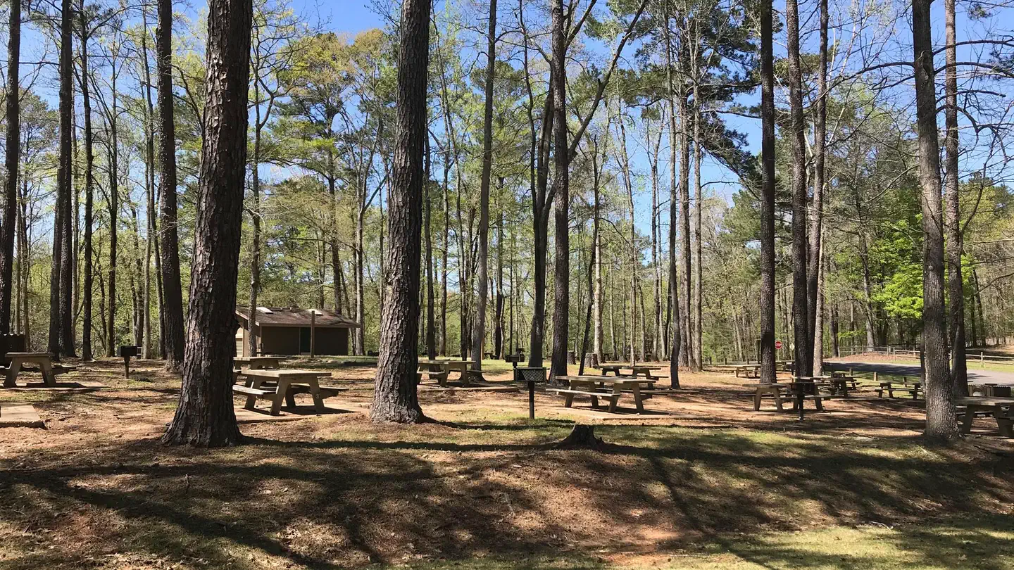
Rocky Branch Day use park is located on Holt Lake on the Black Warrior-Tombigbee Waterway northeast of Tuscaloosa, Alabama. The facility is in a beautiful forest along the shoreline, providing day-use visitors with access to water sports, boating, fishing, swimming, hiking and biking.
Recreation
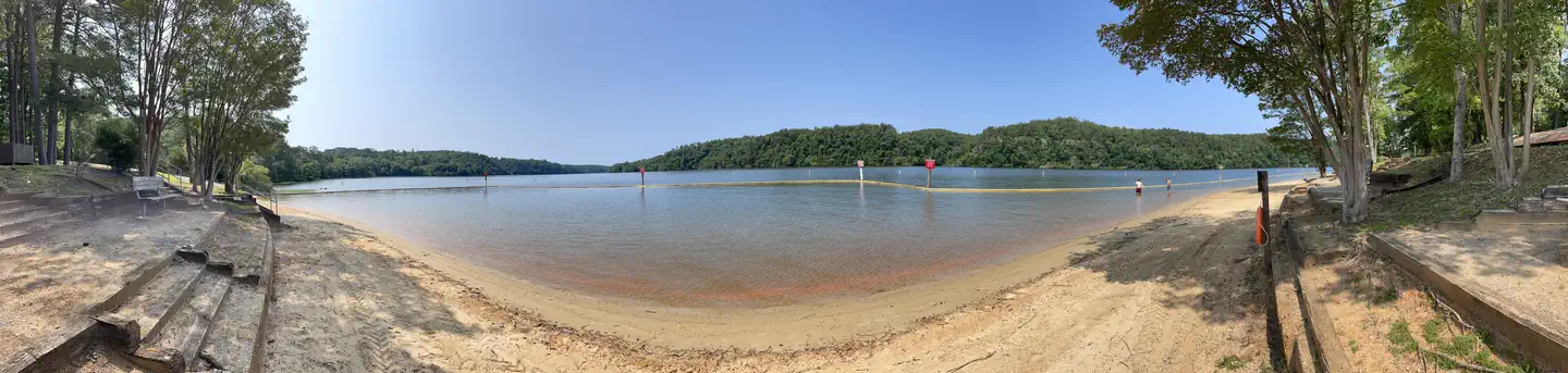
Day Users can explore the lake shore using the hiking trail as well as the swim beach. There are numerous picnic tables and grills to choose from as well as 2 reservable shelters for picnicking.
Facilities
Rocky Branch has 88 picnic sites to choose from with grills nearby. Two group shelters with grills, a water born bathroom as well as an improved and maintained swim beach available for users.
Natural Features
Holt Lake was created by the damming of the Black Warrior River. The campground is situated amidst a mixed pine and hardwood forest, which displays colorful foliage along the riverbanks each fall. Deer, squirrel, wild turkey, migratory birds and blue birds, all live in the Holt Lake area. The Black Warrior-Tombigbee Waterway consists of six lakes with a total length of 457 miles and 39,800 surface acres of water. Temperatures range from the 80s to 90s from April through September, and annual rainfall averages about 60 inches.
Contact Info
Between 05/24/2024 and 09/02/2024 this location is staffed. Please call (205) 388-2458 to speak with local staff. From 09/03/2024 to 05/23/2025 this location is unstaffed. Please call (205) 553-9373 for general information.Nearby Attractions
Boat ramp available year round is adjacent to seasonal day use facilities.
The facts
- 2 bookable sites
- 2 sites for day use only
- Up to 48 people per site
- Loops: Hickory Point Shelter, Hilltop Shelter
Site types
- 2 Group Shelter Nonelectric
2 campsites at Rocky Branch Day Use Park
Check-in 08:00 AM · Check-out 08:30 PM
| Site | Loop | Type | Entry | Surface | Max rig | People | |
|---|---|---|---|---|---|---|---|
| Hickory Point Shelter | Hickory Point Shelter | Group Shelter Nonelectric | — | — | — | 48 | |
| Hilltop Shelter | Hilltop Shelter | Group Shelter Nonelectric | — | — | — | 30 |
Getting there
Coming from Birmingham going south on I-20/59 in Alabama, take Exit 86 (Covered Bridge Road) toward Brookwood. Turn right on Covered Bridge Road and continue for 5.5 miles to traffic light. Turn left at traffic light onto Highway 216 and continue 3.6 miles. Turn right on Rocky Branch Road and continue 2.5 miles until you get to the park gates on your right.
Coming from Tuscaloosa at the intersection of University Blvd and Veterans' Memorial Parkway, continue on Highway 216 for 7.4 miles. Turn left onto Rocky Branch Road and continue for 2.5 miles until you get to the park gate on your right.
33.27323, -87.41255 · 33°16'23.6"N 87°24'45.2"W
Typical weather
| Jan | Feb | Mar | Apr | May | Jun | Jul | Aug | Sep | Oct | Nov | Dec | |
|---|---|---|---|---|---|---|---|---|---|---|---|---|
| High °F | — | — | — | — | — | — | — | — | — | — | — | — |
| Low °F | — | — | — | — | — | — | — | — | — | — | — | — |
| Precip in | 5.2 | 5.5 | 4.8 | 4.5 | 3.6 | 4.6 | 4.0 | 4.2 | 3.2 | 3.1 | 4.3 | 4.9 |
1991–2020 averages from the nearest NOAA station, 2.6 mi away — not measured at the facility itself, and elevation can make a real difference over that distance.
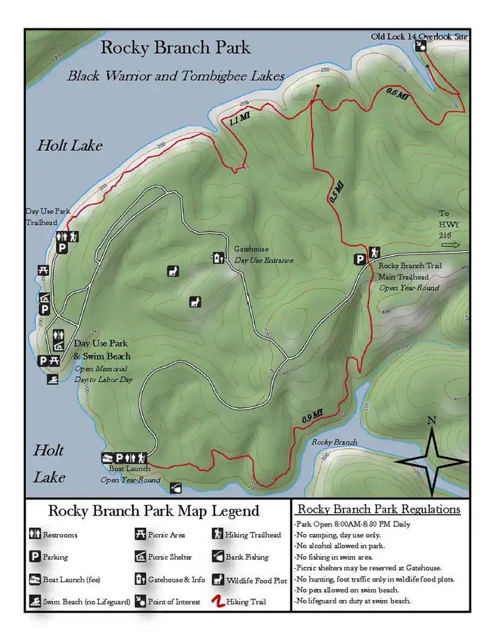
Map
More photos
Member photos
Common questions about Rocky Branch Day Use Park
- Can you reserve a site at Rocky Branch Day Use Park?
- Yes, Rocky Branch Day Use Park is reservable through Recreation.gov.
- How many campsites does Rocky Branch Day Use Park have?
- 2 sites.
Camping near Rocky Branch Day Use Park
- Deerlick Creek 1.4 mi · Campground · we watch it
- Burchfield Branch Park 11.8 mi · Campground · we watch it
- Lock 8 33.7 mi · Campground · we watch it
- Finches Ferry 38.5 mi · Campground · we watch it
- Jennings Ferry 39.6 mi · Campground · we watch it
- Lock 6 44.7 mi · Campground · we watch it
- Pickensville CG (Pickensville Al) 50 mi · Campground · we watch it
- South Sandy Shooting Range 19.2 mi · Facility
- Payne Lake Recreation Area 26.7 mi · Facility
- Vick Shooting Range 32.4 mi · Facility
- A.G. Gaston Motel (Temporarily Closed) 38.3 mi · Visitor Center
- Temporary Visitor Center (Birmingham Civil Rights Institute) 38.4 mi · Visitor Center
Contact
- Phone Gatehouse 205-554-1684 Resource Office 205-553-9373
- Email bwthelp@usace.army.mil
- Book Recreation.gov
Recreation.gov last updated this record on 2026-03-11.
Facility information and photographs from Recreation.gov (RIDB). SpotOpened is not affiliated with Recreation.gov or any federal agency.
Comments