Togiak Wilderness
Facility · Alaska ·
Managed by the Fish and Wildlife Service
Dillingham Alaska Native Village Statistical Area (E1)
- 78 ft
- Elevation
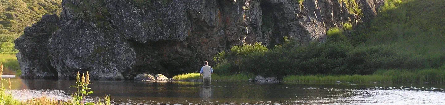
The Togiak Wilderness now contains a total of 2,274,066 acres and is managed by the Fish & Wildlife Service's a, href="http://www.fws.gov/refuge/togiak/">Togiak National Wildlife Refuge. All of the Wilderness is in the state of Alaska. In 1980 the Togiak Wilderness became part of the now over 110 million acre National Wilderness Preservation System.
At 4.2 million acres, Togiak National Wildlife Refuge covers about the same amount of land as Connecticut and Rhode Island combined, a region important to Eskimo and Native American hunter-gatherers for more than 5,000 years. Over half of the refuge, the northern section, has been designated Wilderness. To the north of Togiak Wilderness stretches the vast Yukon Delta National Wildlife Refuge. Three major river systems, comprising over 1,500 miles of water, lie within Togiak Refuge (Togiak, Kanektok, and Goodnews). More than one million salmon return to these waters each year to spawn. Fishing draws many visitors to Togiak, both humans and brown bears. Floaters often run the rivers, fishing along the way for salmon, trout, char, grayling, and pike. The Togiak River flows wide and easily. The Kanektok and Goodnews are faster, more twisted rivers with a greater variety of fish. None of the rivers contain white water.
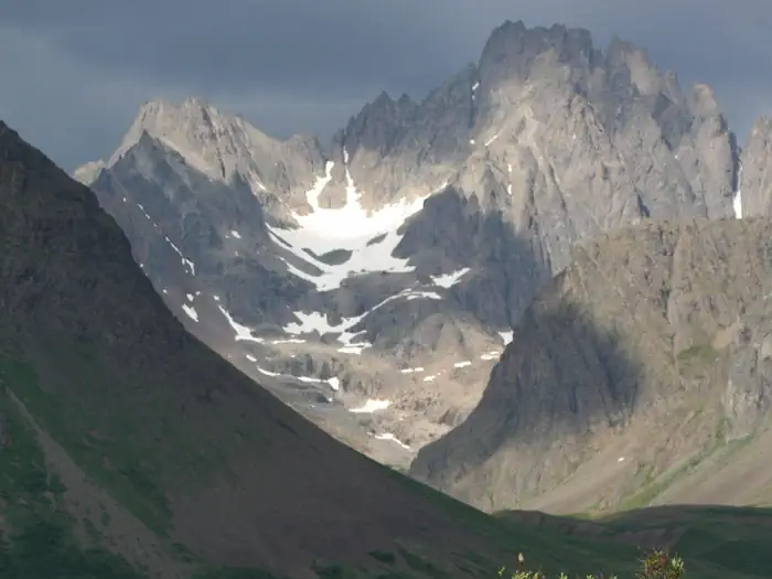
The Ahklun Mountains encompass about 80 percent of Togiak National Wildlife Refuge and give way to tundra and coastal plains at lower elevations. The mountains of the Wilderness hide many large lakes. Sea cliffs provide nesting places for approximately one million marine birds, including murres, puffins, auklets, kittiwakes, and cormorants. Beaches provide haul-outs for walrus, sea lions, and harbor seals. Seven species of whales have been identified cruising the coastline during migratory seasons.
You'll find no trails, just millions of mosquitoes in summer, severe winters, few trees, and fewer fellow humans.
Getting there
Togiak Refuge begins about 350 air miles southwest of Anchorage. Travelers come by air because as elsewhere in bush Alaska, no roads connect the Refuge or the nearby communities with the rest of the state. Our Travel to the Refuge map (216 KB PDF) shows the route.
Commercial airlines fly daily to Dillingham, Bethel and King Salmon from Anchorage. Barges supply these communities during the summer, but there is no passenger service to southwest Alaska by water.
Primary access to Togiak Refuge itself is by chartered aircraft. Dillingham is the hub for many of the air taxis that have permits to operate within the Refuge, although some air taxis fly from Bethel and King Salmon. Typically, air taxis will drop off passengers and gear and return at a designated time and place for pick up.
59.03972, -158.45750 · 59°2'23.0"N 158°27'27.0"W
Typical weather
Typically 65°F in Jul, down to 24°F in Jan.
| Jan | Feb | Mar | Apr | May | Jun | Jul | Aug | Sep | Oct | Nov | Dec | |
|---|---|---|---|---|---|---|---|---|---|---|---|---|
| High °F | 24 | 30 | 32 | 45 | 55 | 62 | 65 | 63 | 56 | 44 | 32 | 26 |
| Low °F | 10 | 15 | 15 | 28 | 36 | 44 | 49 | 48 | 41 | 29 | 18 | 11 |
| Precip in | 0.9 | 0.9 | 0.8 | 1.0 | 1.4 | 1.8 | 2.5 | 3.3 | 3.4 | 2.3 | 1.7 | 1.4 |
1991–2020 averages from the nearest NOAA station, 69.9 mi away — not measured at the facility itself, and elevation can make a real difference over that distance.
Map
More photos
Member photos
Common questions about Togiak Wilderness
- Can you reserve a site at Togiak Wilderness?
- No. Togiak Wilderness is not reservable through Recreation.gov, so sites are first-come, first-served or booked elsewhere.
Contact
- Phone 907-842-1063 or 1-800-817-2538
- Email togiak@fws.gov
- Info Recreation.gov
Recreation.gov last updated this record on 2026-02-25.
Facility information and photographs from Recreation.gov (RIDB). SpotOpened is not affiliated with Recreation.gov or any federal agency.
Comments