Forrester Island Wilderness
Facility · Alaska ·
Managed by the Fish and Wildlife Service
Alaska Maritime National Wildlife Refuge (NWR) · Restricted Access
- 1,237 ft
- Elevation
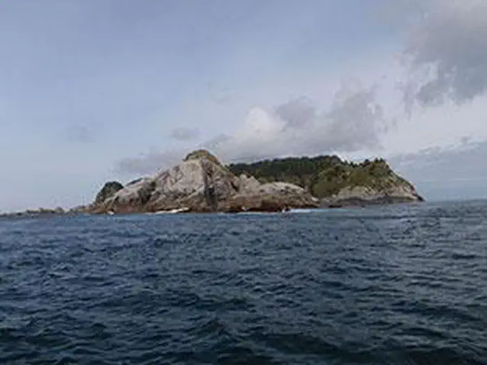
The Forrester Island Wilderness now contains a total of 2,832 acres and is managed by the Fish & Wildlife Service's Alaska Maritime National Wildlife Refuge. All of the Wilderness is in the state of Alaska. In 1970 the Forrester Island Wilderness became part of the now over 110 million acre National Wilderness Preservation System.
During the day you'll ask yourself how more than one million birds of 13 species could be nesting on Forrester Island Wilderness. But at night vast populations of Leach's storm petrels, fork-tailed petrels, Cassin's auklets, and rhinoceros auklets leave their underground burrows to feed in the ocean around the isolated islands of Forrester, Lowrie, and Petrel. An estimated 780,000 storm petrels nest on Petrel Island alone. These islands and numerous nearby rocks were established as a wildlife refuge in 1912, and were designated Wilderness in 1970. In 1980 they were added as a subunit of the 475,000-acre Gulf of Alaska Unit of the Alaska Maritime National Wildlife Refuge, at the southeastern end of the state.
Forrester Island itself lies under a heavy forest of spruce and hemlock with a few lodgepole pine and red cedar bordering open muskegs. In small ravines and in areas of windfall on this mountainous piece of land the thick scrub, a web of berry bushes and devil's club, discourages travel. The shoreline has many sheer cliffs and few beaches, as does the shoreline of Petrel Island, which is also heavily forested. The nearby Lowrie Islands lie essentially flat.
To schedule your visit for the best time, avoid the spring nesting season. Almost all the available soil contains lengthy burrows, and one false step could end many of the lives developing within buried eggs.
Getting there
A journey to the far-flung lands of the Forrester Island Wilderness within the Alaska Maritime Refuge almost always involves a boat. Tour boats, ferries, planes , cruise ships or your own boat can transport you to parts of the refuge. No refuge lands are accessible from the road system. Homer and Seward are the only road accessible communities near the refuge. All other communities in and near the refuge are accessible by scheduled air service and some such as Sitka, Seldovia, Kodiak, Chignik, Sand Point, King Cove, Cold Bay, False Pass, Akutan and Unalaska also have ferry service.
For those not ready to set sail, the Alaska Islands & Ocean Visitor Center and Refuge headquarter at 95 Sterling Highway # 1, Homer, Alaska, can be reached by vehicle and scheduled aircraft from Anchorage (225 miles).
54.79732, -133.52597 · 54°47'50.3"N 133°31'33.5"W
Typical weather
Typically 61°F in Aug, down to 39°F in Jan.
| Jan | Feb | Mar | Apr | May | Jun | Jul | Aug | Sep | Oct | Nov | Dec | |
|---|---|---|---|---|---|---|---|---|---|---|---|---|
| High °F | 39 | 40 | 42 | 47 | 53 | 57 | 60 | 61 | 57 | 50 | 43 | 40 |
| Low °F | 33 | 32 | 33 | 37 | 43 | 48 | 52 | 53 | 48 | 42 | 36 | 34 |
| Precip in | 9.1 | 6.9 | 8.1 | 7.2 | 5.5 | 4.0 | 5.1 | 7.3 | 10.4 | 13.1 | 12.3 | 10.9 |
1991–2020 averages from the nearest NOAA station, 49.4 mi away — not measured at the facility itself, and elevation can make a real difference over that distance.
Map
Member photos
Common questions about Forrester Island Wilderness
- Can you reserve a site at Forrester Island Wilderness?
- No. Forrester Island Wilderness is not reservable through Recreation.gov, so sites are first-come, first-served or booked elsewhere.
Camping near Forrester Island Wilderness
- Point Amargura Cabin 45.9 mi · Campground · we watch it
- Josephine Lake Cabin 49.5 mi · Campground · we watch it
- Twelvemile Cabin 50.5 mi · Campground · we watch it
- Harris River Campground 53.3 mi · Campground · we watch it
- Polk Camp 55.5 mi · Campground · we watch it
- Kegan Creek Cabin 55.7 mi · Campground · we watch it
- Kegan Cove Cabin 56 mi · Campground · we watch it
- Black Bear Lake Cabin (Tongass National Forest, AK) 57.7 mi · Campground · we watch it
- Josephine Lake Cabin 51.4 mi · Campground
Contact
- Phone 907-235-6546
- Email alaskamaritime@fws.gov
- Info Recreation.gov
Recreation.gov last updated this record on 2026-02-25.
Facility information and photographs from Recreation.gov (RIDB). SpotOpened is not affiliated with Recreation.gov or any federal agency.
Comments