El Capitan Campground
Campground · Alaska · 3 bookable sites ·
Managed by the USDA Forest Service
Tongass National Forest (NF) · Open Access
- 3
- Bookable sites
- 49 ft
- Elevation
Overview
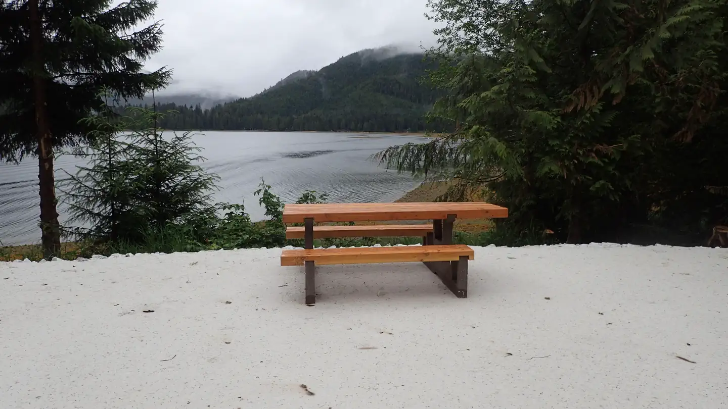
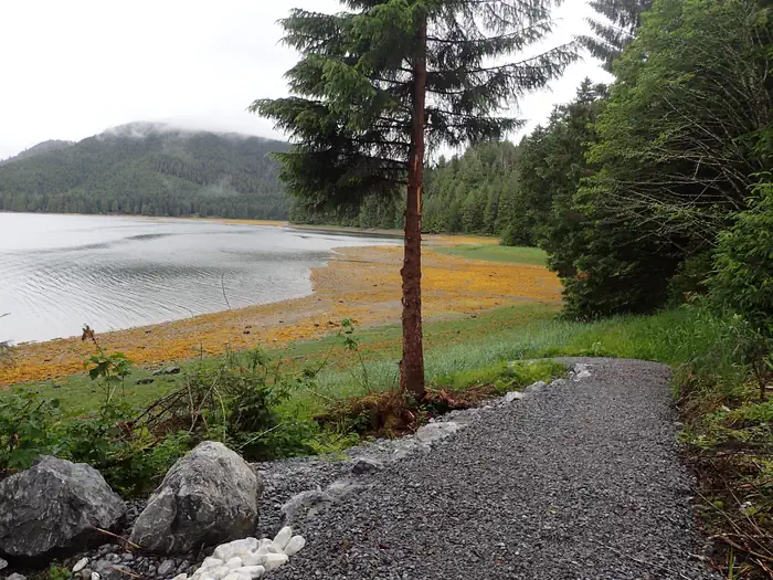
This waterfront campground offers a scenic view of the beautiful El Capitan Passage. This site has access to fishing, hunting, kayaking, hiking, caving and marine dock. It provides a remote, scenic setting for recreation and relaxation on the Tongass National Forest.
Recreation
The El Capitan Campground is nearby many opportunities Prince of Wales island has to offer. Salmon fishing is popular during the summer months as well as fall deer hunting, beach combing and other marine sports including paddle craft and sea kayaking. The nearby El Capitan Cave offers guided tours during the summer season and is the longest mapped cave in Alaska at over two miles.
Facilities
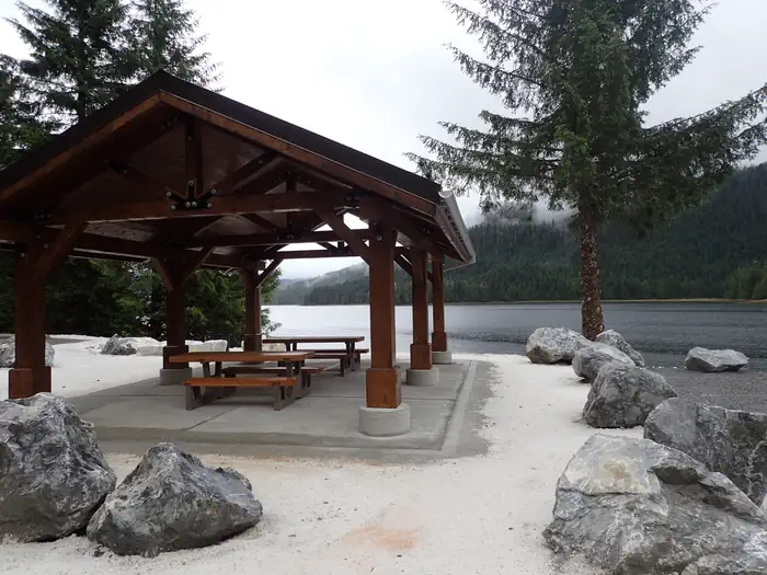
There is access to an accessible outhouse as well as a nearby covered picnic pavillion and marine dock.
Natural Features
The El Capitan Campground is in an area of high geologic interest including the El Cap Cave. The surrounding forest boasts old growth species such as yellow cedar, red cedar, hemlock, and Sitka spruce. There is abundant wildlife viewing for both aquatic and terrestrial species including Sitka black tail deer, black bear, harbor seals, otters and many fish species. Prince of Wales Island has runs of every salmon species except chinook as well as populations of cutthroat trout and Dolly Varden.
Nearby Attractions
Prince of Wales Island Visitor Guide can be found on the Prince of Wales Chamber of Commerce website.
The facts
- 3 bookable sites
- Loops: El Cap Campground
Site types
- 3 Standard Electric
3 campsites at El Capitan Campground
| Site | Loop | Type | Entry | Surface | Max rig | People | |
|---|---|---|---|---|---|---|---|
| 1 | El Cap Campground | Standard Electric | — | — | — | — | |
| 2 | El Cap Campground | Standard Electric | — | — | — | — | |
| 3 | El Cap Campground | Standard Electric | — | — | — | — |
Getting there
El Capitan Campground can be reached by vehicle, boat, or plane. By road, follow Forest Service Road 20 to Forest Service Road 15 and take a left for about a mile (1.6 km) to the cave. Watch for signs. From both Thorne Bay and Craig is an estimated 3-hour drive. There is a Forest Service dock for use by boats and planes, but they should not be left unattended. No boats over 24' are allowed. Boats over 24' will need to anchore out and skiff in.
56.16249, -133.32101 · 56°9'45.0"N 133°19'15.6"W
Typical weather
Typically 61°F in Aug, down to 38°F in Jan.
| Jan | Feb | Mar | Apr | May | Jun | Jul | Aug | Sep | Oct | Nov | Dec | |
|---|---|---|---|---|---|---|---|---|---|---|---|---|
| High °F | 38 | 39 | 41 | 47 | 53 | 57 | 60 | 61 | 56 | 49 | 42 | 39 |
| Low °F | 31 | 31 | 32 | 36 | 42 | 46 | 49 | 49 | 46 | 40 | 35 | 32 |
| Precip in | 8.4 | 5.2 | 5.1 | 4.8 | 4.8 | 2.9 | 5.0 | 6.6 | 10.7 | 11.1 | 9.3 | 8.4 |
1991–2020 averages from the nearest NOAA station, 17.5 mi away — not measured at the facility itself, and elevation can make a real difference over that distance.
Map
Fees and stay limits
$15 per night
From Recreation.gov, which is not always current. The operator's own page is the authority on what you will be charged.
More photos
Member photos
Common questions about El Capitan Campground
- Can you reserve a site at El Capitan Campground?
- Yes, El Capitan Campground is reservable through Recreation.gov.
- How many campsites does El Capitan Campground have?
- 3 sites.
Camping near El Capitan Campground
- El Capitan Cabin 0.1 mi · Campground · we watch it
- Red Bay Lake Cabin 5.4 mi · Campground · we watch it
- Shipley Bay Cabin 8.5 mi · Campground · we watch it
- Salmon Bay Lake Cabin 8.5 mi · Campground · we watch it
- Sarkar Lake Cabin 14.8 mi · Campground · we watch it
- Barnes Lake Cabin 17 mi · Campground · we watch it
- Sweet Water Lake Cabin 20.7 mi · Campground · we watch it
- Steamer Bay Cabin 24.3 mi · Campground · we watch it
- Red Bay Lake Cabin 6.3 mi · Campground
- Sarkar Lake Cabin 14.4 mi · Campground
- Sweetwater Lake Cabin 20.8 mi · Campground
- Raven's Roost Cabin 24 mi · Campground
Contact
- Phone 907-828-3304
- Book Recreation.gov
Recreation.gov last updated this record on 2026-03-11.
Facility information and photographs from Recreation.gov (RIDB). SpotOpened is not affiliated with Recreation.gov or any federal agency.
Comments