Arctic Circle Campground
Campground · Alaska · 18 bookable sites ·
Managed by the Bureau of Land Management
Central Yukon Field Office · Open Access
- 18
- Bookable sites
- 19
- Accessible sites
- 1,314 ft
- Elevation
Overview
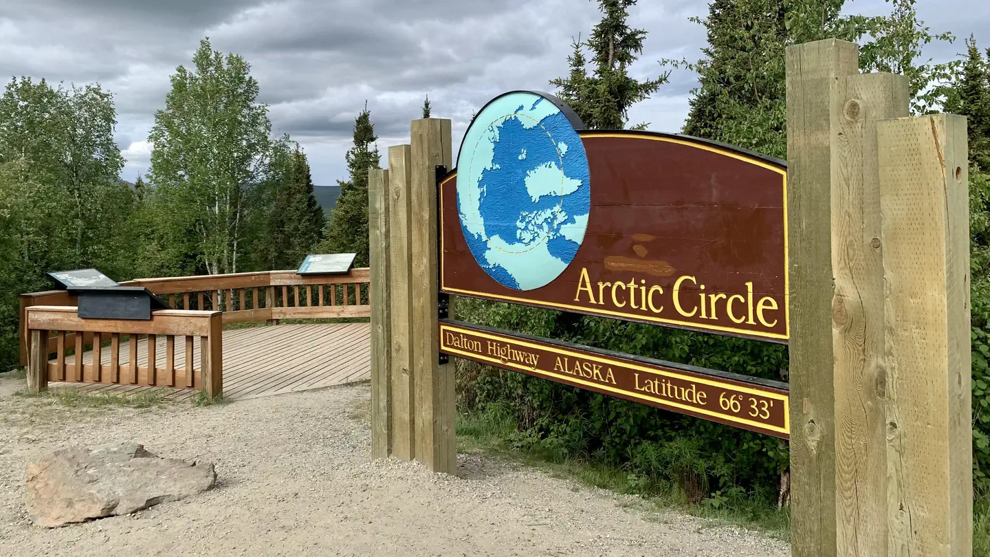
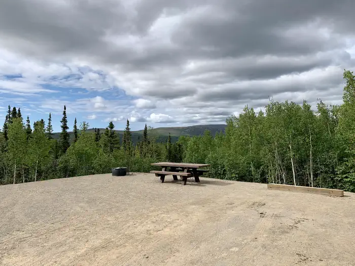
Arctic Circle Campground is located on a beautiful mixed forest hillside at the Arctic Circle. It was fully renovated in 2021. There are some views of nearby hills and the Kanuti Flats. It is located ½ mile east (uphill) from the Dalton Highway and Arctic Circle sign. The campground is a perfect stop for those exploring their way up the Dalton Highway. There are 19 accessible campsites.
This location is available on a first-come, first-serve basis only. Visitors are required to physically arrive at the campground to claim and purchase a site. Once on-site, you can pay for your campsites(s) by scanning a QR code using the Recreation.gov mobile app. Download the free Recreation.gov mobile app on Android or iOS prior to your arrival as this is a remote area that has limited or no cellular service.
Recreation
The hills in the area are remote with rugged terrain and offer no developed routes. Backcountry hiking opportunities can be found on ridges in the area. Be advised that hiking can be difficult due to tussocks, wet ground and uneven footing. Choose your route with care and bring topographic maps, a satellite communication device, a GPS and a compass with you if you choose to go exploring.
Fishing opportunities are numerous in this area. Try your luck in the aptly named Fish Creek at the base of the hill, or just a little ways to the north are the two forks of Bonanza Creek. Make sure you have a State of Alaska fishing license and know the regulations for the area you are fishing.
Panning for gold is also allowed on a several federal stream segments along the Dalton Highway south of Atigun Pass (Milepost 244). No panning is permitted in the pipeline right-of-way (27 feet/8.2 m on either side of the pipeline) and no panning on federal mining claims without permission. Suction dredging is prohibited in the Utility Corridor. Visit the BLM Public Room in Fairbanks (222 University Ave, Fairbanks, Alaska) or the Arctic Interagency Visitor Center in Coldfoot, Alaska, to get information on where you may legally pan for gold.
The Jim River can be a nice Class I-II float trip with several access points along the highway. Watch out for sweepers and strainers!
Other recreational activities include bird watching and bicycling.
State statute prohibits off-road vehicle use within five miles either side of from the highway from the Yukon River to the Arctic Ocean.
Facilities
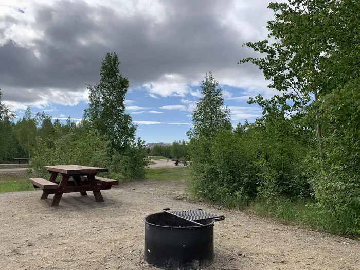
The roads, and parking aprons have a gravel surface. Six sites are pull-through allowing easy access for RVs, eleven sites are back-in, and there are two walk-in campsites. There are vault toilets, trash receptacles and bear resistant food lockers. Each campsite has a fire ring and picnic table. A camp-host is onsite. Water is not available at the campground and there is no electricity and no dump station.
Natural Features
The campsites are situated in a mixed forest with views of the nearby hills and the Kanuti Flats National Wildlife Refuge. The surrounding forest provides habitat for squirrels, marten, lynx, wolf and brown and black bears. A variety of birds migrate north to breed in the area. Some of the resident birds include ravens, grouse, and chickadees.
Contact Info
For facility specific information, please call (907) 474-2200.Nearby Attractions
The Arctic Circle sign is located nearby. Take your photo in front of the sign and get your certificate to prove to your friends and family that you were there!
Drive north about 20 miles to Gobblers Knob to get expansive views of the Brooks Range and Kanuti Flats National Wildlife Refuge. Drive just a little further and you can visit Coldfoot, which is located in the foothills of the Brooks Range. Fuel, food, lodging and cell service are available at Coldfoot.
The facts
- 18 bookable sites
- 19 sites in total, including non-bookable
- 19 accessible sites
- Loops: 1
Site types
- 16 Standard Nonelectric
- 2 Walk To
- 1 Management
19 campsites at Arctic Circle Campground
| Site | Loop | Type | Entry | Surface | Grade | Access | Max rig | People | |
|---|---|---|---|---|---|---|---|---|---|
| Camp Host | 1 | Management | — | — | — | — | — | — | ♿ |
| Site 10 | 1 | Standard Nonelectric | Back In | Gravel | — | — | — | — | ♿ |
| Site 11 | 1 | Standard Nonelectric | Pull Through | Gravel | — | — | — | — | ♿ |
| Site 12 | 1 | Standard Nonelectric | Back In | Gravel | — | — | — | — | ♿ |
| Site 13 | 1 | Standard Nonelectric | Back In | Gravel | — | — | — | — | ♿ |
| Site 14 | 1 | Standard Nonelectric | Pull Through | Gravel | — | — | — | — | ♿ |
| Site 15 | 1 | Standard Nonelectric | Back In | Gravel | — | — | — | — | ♿ |
| Site 16 | 1 | Standard Nonelectric | Pull Through | Gravel | — | — | — | — | ♿ |
| Site 17 | 1 | Standard Nonelectric | Back In | Gravel | — | — | — | — | ♿ |
| Site 18 | 1 | Walk To | — | Gravel | Slight | Hike In | — | — | ♿ |
| Site 19 | 1 | Walk To | — | Gravel | Slight | Hike In | — | — | ♿ |
| Site 2 | 1 | Standard Nonelectric | — | — | — | — | — | — | ♿ |
| Site 3 | 1 | Standard Nonelectric | Back In | Gravel | — | — | — | — | ♿ |
| Site 4 | 1 | Standard Nonelectric | Back In | Gravel | — | — | — | — | ♿ |
| Site 5 | 1 | Standard Nonelectric | Pull Through | Gravel | — | — | — | — | ♿ |
| Site 6 | 1 | Standard Nonelectric | Back In | Gravel | — | — | — | — | ♿ |
| Site 7 | 1 | Standard Nonelectric | Pull Through | Gravel | — | — | — | — | ♿ |
| Site 8 | 1 | Standard Nonelectric | Back In | Gravel | — | — | — | — | ♿ |
| Site 9 | 1 | Standard Nonelectric | Back In | Gravel | — | — | — | — | ♿ |
Getting there
From Fairbanks, drive north 11 miles on the Steese Highway (AK-6) to its junction with the Elliott Highway (AK-2) in Fox. Follow the Elliott Highway 73 miles to the junction with the Dalton Highway (AK-11). Continue on the Dalton to Arctic Circle Campground at Milepost 115.
It is about 200 miles from Fairbanks to Arctic Circle Campground, and the trip can take from 5 to 7 hours depending on weather, road conditions, and how often you stop along the way.
The campground is on the east side of the highway (right as you head north) and is located approximately ½ mile up the hill via an access road at the north end of the wayside.
66.55800, -150.79320 · 66°33'28.8"N 150°47'35.5"W
Typical weather
| Jan | Feb | Mar | Apr | May | Jun | Jul | Aug | Sep | Oct | Nov | Dec | |
|---|---|---|---|---|---|---|---|---|---|---|---|---|
| High °F | — | — | — | — | — | — | — | — | — | — | — | — |
| Low °F | — | — | — | — | — | — | — | — | — | — | — | — |
| Precip in | 0.8 | 0.9 | 0.7 | 0.6 | 0.9 | 1.5 | 2.9 | 4.1 | 2.7 | 1.6 | 1.5 | 1.2 |
1991–2020 averages from the nearest NOAA station, 13.7 mi away — not measured at the facility itself, and elevation can make a real difference over that distance.
Map
Fees and stay limits
$12 per night. First come first serve only. Campground is open from mid-May through end of September (depending on snowfall).
From Recreation.gov, which is not always current. The operator's own page is the authority on what you will be charged.
More photos
Member photos
Common questions about Arctic Circle Campground
- Can you reserve a site at Arctic Circle Campground?
- Yes, Arctic Circle Campground is reservable through Recreation.gov.
- How many campsites does Arctic Circle Campground have?
- 19 sites in total, of which 18 can be booked.
Camping near Arctic Circle Campground
- Coldfoot Cabin 50.8 mi · Campground · we watch it
- Marion Creek Campground 55.2 mi · Campground · we watch it
- Arctic Circle Wayside 0.5 mi · Facility
- Bettles Ranger Station and Visitor Center 31.8 mi · Facility
- Five Mile Campground 51.7 mi · Campground
- Marion Creek Campground 55.2 mi · Campground
Contact
- Book Recreation.gov
Recreation.gov last updated this record on 2026-02-25.
Facility information and photographs from Recreation.gov (RIDB). SpotOpened is not affiliated with Recreation.gov or any federal agency.
Comments